
When we added drones to our fleet in 2015, we had already spent more than two decades shooting commercial projects from helicopters and fixed-wing aircraft. Since then, drones have become one of the most-used tools on our team.
They have also reshaped what developers, contractors, architects, and marketers expect from a commercial photographer. In this guide, we’ll walk through what changed, where drones make the biggest difference today, and when a manned aircraft is still the better call.
What Commercial Aerial Photography Looked Like Before Drones
For most of our history, an aerial photo meant a flight in a helicopter or small plane. We first photographed Hartsfield-Jackson Atlanta International Airport in 1992, on film.
Manned flights are still very efficient for large areas. On a planned route, our crew can cover many job sites in a single flight hour, which is why helicopter and fixed-wing aerial photography is still our go-to for regional progress routes.
Where manned aircraft struggled was the low, close work. A slow pass along a building facade, a detail shot of rooftop equipment, or a video that rises from street level to the skyline was either very hard to get or out of reach.
Ground photographers covered what they could from lifts, ladders, and neighboring rooftops. Many useful angles were left unshot.
How Drones Have Changed Commercial Photography
Here are the biggest shifts we’ve seen over a decade of flying drones for commercial clients across the Southeast.
- Low-altitude views became affordable. A drone works the space between a ground camera and a helicopter, from rooftop height up to 400 feet. Architects and developers can now get detail shots of a facade, roofline, or site entrance without booking an aircraft.
- Construction progress went on a schedule. A drone can launch from the site in minutes, so many contractors now document progress from the same points every month or even every week. Our guide on how to photograph a construction site covers how to set that up.
- Marketing gained motion. Smooth reveal videos, twilight footage of new buildings, and FPV fly-throughs are now standard requests for leasing and sales campaigns.
- Photos started doubling as data. With the right flight plan, the same images can be stitched into orthomosaic maps and 3D models. We explain where that line falls in the difference between aerial photography and aerial mapping.
- Turnaround got faster. Smaller sites can be flown, edited, and delivered quickly, which helps when an investor update or a ribbon cutting is already on the calendar.
Drone Photography Is Now a Standard Tool on Construction Sites
Construction is where we’ve watched adoption move fastest, and the industry numbers back that up. In a May 2026 survey of its contractor members, Associated Builders and Contractors found that 36.1% now use drones on their jobsites.
Among those contractors, 80.8% use drones for site progress monitoring and 77.5% use them for marketing and media. Those are the same two jobs our clients hire us for most often.
The survey also shows why so many companies still bring in a specialist. Regulatory and compliance issues were the top barrier at 53.5%, followed by training and staffing at 43.4%.
That matches what we hear from project managers. Buying a drone is the easy step. Keeping certified pilots available, planning around airspace rules, and turning raw footage into images an owner or lender can use takes steady time and attention. That’s the gap our commercial drone photography and video team fills.
Drone vs. Manned Aircraft: Which Is Right for Your Project?
We qualify every project before we quote it, because the right aircraft depends on the site, the airspace, and the shots you need. Here’s a quick look at how we compare the two.
| Drone | Helicopter or Fixed-Wing | |
|---|---|---|
| Best for | Single buildings and sites, close detail, facades, rooftops | Multiple sites in one trip, large campuses, remote locations |
| Typical altitude | Ground level up to 400 feet | About 500 to 3,000 feet |
| Sites per flight hour | Usually 2 to 3, because of setup time at each location | 10 to 30 on a planned route |
| Near major airports | Needs FAA airspace authorization, often with low altitude limits | Coordinated directly with the control tower |
| Video | Low passes, building reveals, FPV and indoor flights | Sweeping overhead footage of large sites and skylines |
| Mapping | Orthomosaics and 3D models of a single site | Vertical photography of properties and surrounding neighborhoods |
If your project is a single building or a site where close detail matters, a drone is usually the better value. If you have a list of sites across a metro area, or your property sits near a busy airport, a manned flight often costs less per site and gets more done.
We break down the math in our post on why manned aerial photography can cost less than drone services.
A Real Example: Why We Still Fly a Helicopter Over Hartsfield-Jackson
Our longest-running project shows how airspace can make the decision for you. We’ve photographed Hartsfield-Jackson Atlanta International Airport since 1992, and today we fly over it about once a month to document construction progress on its concourse and terminal projects.
The airport sits in Class B airspace, with five runways and a nonstop flow of arrivals and departures. Under FAA rules, drone pilots need an airspace authorization before flying in controlled airspace around airports. Any request above the altitude the FAA has set for that area goes through a manual review instead of an automatic approval.
For a recurring shoot directly over active runways, our helicopter crew is the safest and simplest option. Our pilot radios the tower, requests a photo flight in Class B, and we capture the whole airfield in one pass.
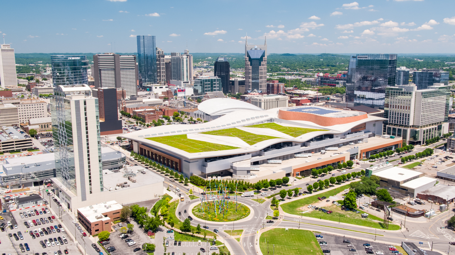
Compare that with the 505 Church Street tower in downtown Nashville, where drones were a natural fit for skyline imagery and the completion video. Both projects had the same goal of clear progress and marketing images, and each one called for a different aircraft.
More Drone Pilots Means Vetting Matters More
The number of people licensed to fly drones commercially keeps climbing. The FAA’s latest aerospace forecast counts 493,396 certificated remote pilots in 2025 and projects about 628,600 by 2030.
That growth is good for the industry. It also means a license alone tells you very little about who will show up on your site. Before you hire anyone for commercial drone photography, ask these questions.
- Are you FAA certified and insured? Every commercial pilot needs a remote pilot certificate, and you should see proof of liability coverage. Our guide to drone permits, licenses, and registration covers the details.
- How much flight time do you have? Experience in tight spaces, wind, and busy airspace shows up in the final images. Here’s why flight hours matter when you’re choosing a pilot.
- Can you get the approvals my site needs? Ask how they handle airspace authorizations, night flights, and flights over people.
- Who handles editing and delivery? Post-production, file formats, and turnaround times should be spelled out before anyone flies.
- Do you have backup pilots? A team with several pilots can keep a progress schedule on track when weather or a conflict moves the date.
Plan Your Next Aerial Shoot With Aerial Innovations Southeast
From our offices in Nashville and Atlanta, we cover commercial projects across Tennessee, Kentucky, Alabama, and Georgia with drones, helicopters, fixed-wing aircraft, and ground photo and video crews.
Tell us about your site and what you need to show, and we’ll recommend the right approach. Contact our team to get started, or browse more of our commercial case studies.
Frequently Asked Questions About Commercial Drone Photography
Is drone photography cheaper than hiring a helicopter?
For a single property, usually yes. For several sites in the same area, a manned flight can cost less per site because the crew covers more ground each hour. See our full breakdown of how much drone photography costs.
Do commercial drone photographers need a license?
Yes. Anyone flying a drone for business in the U.S. needs an FAA remote pilot certificate and a registered aircraft. Flights in controlled airspace near airports also need an FAA airspace authorization.
How often should construction progress be photographed?
Monthly is a common rhythm, and fast-moving projects sometimes go weekly. Shooting from the same positions each time makes it easy to line up one set of photos against the last.
Can drones fly at night or indoors?
Yes, with the right planning and approvals. We fly night shoots for twilight building reveals and use FPV drones for indoor walkthrough footage.